Due to the lush vegetation in the mountainous section of the Guangzhou-Yong Railway and the steep terrain of many karst peaks, peak clusters and other terrains, geologists cannot reach it, resulting in gaps in geological data. In view of the many and dense fractures, karst development,
Many unfavorable situations such as numerous underground rivers and complex hydrogeological conditions,China Railway selects complex sections during the bidding and preliminary survey stages, and adopts comprehensive survey methods to carry out method verification;Used in the test area
Geological mapping combined with comprehensive survey methods of high-precision remote sensing, aeromagnetic exploration and natural source audio-frequency magnetotelluric method has initially identified large-scale structures in the region.and karst development, which solves the problem that the site is limited due to terrain
Geological gap data issues that personnel cannot investigate.
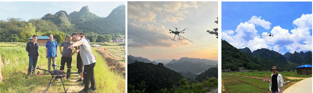
In July 2020, the Jiataiko GTK-RM600 drone optical pump aeromagnetic system completed aeromagnetic detection in the mountainous test area of the Guangyong Railway. The system is flexible, efficient, fast, precise and accurate, with low operating costs.
Characteristics such as short production cycles can break through natural conditions and human beings to a certain extent.Capacity limitations, replacing ground staff for long-distance (difficult to reach)and high-risk areas, capable of operating on complex ground and meteorological strips
Flight missions are carried out under software, achieving low-risk, low-cost and high-quality aviationGeophysical survey operations. Provide efficient and rapid technical equipment for geological prospecting, engineering survey and environmental survey work.
