Recently, the Aeronautical Physical Survey Center of the Shandong Province Academy of Geophysical and Geochemical Exploration and Exploration and Jiataike (Shenzhen) Technology Co., Ltd. jointly implemented the 1: 10,000 drone aeromagnetic survey project near Lianhuashan, Chenghai District, Shan Tou City, Guangdong Province.The purpose is to use a high-precision magnetometer mounted on a drone platform to carry out ultra-low-altitude drone aeromagnetic measurements, infer the spatial distribution characteristics of underground soil composition and shallow structures in the target area, and provide basic data for environmental protection projects.
The terrain of the survey area is very complex, with an area of 16.4km2, about 4.57km long in the east-west direction, and about 3.58km long in the north-south direction. The low point in the region is 3.6 meters above sea level, and the highest point is 553 meters above sea level.The southwest and northeast corners are mainly mountainous areas, with complex terrain and severe terrain cutting. The mountain height difference in the southwest corner is large and the mountain is steep. Due to the mountain blocking and no way to reach it, there is a long drone blind flight segment, which increases the risk. A high-voltage line is set up in the survey area across the entire survey area from the north to the southwest. During the survey, it is measured by small drones. The general high-pressure tower is about 50 meters above the ground; there are 6 huge wind turbines in the northeast corner of the survey area. Distributed densely, through small drones during the survey, the windmill tower body and blades are about 150 meters above the ground. High-voltage towers and wind turbines have a huge impact on the safety of magnetic measurement of drones. The flying altitude of the measurement area is 90 meters above the ground.
After several days of intensive and orderly flights, all aeromagnetic data collection was successfully completed and a report was submitted.
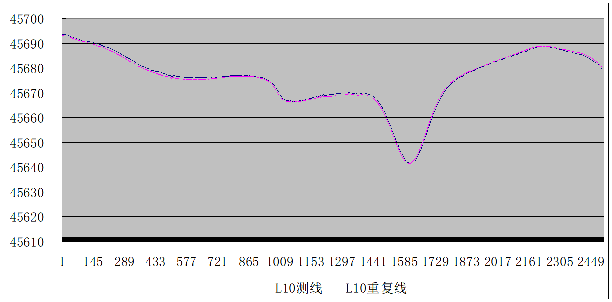
The quality of the project's flight data is good. For quality statistics based on repeated lines, take a certain survey line.The mean square error of the difference was calculated to be 0.23nT. The curve is as follows: